
Mississippi River Delta, USA
https://goo.gl/maps/3R3gf3Cg13A2
.
.
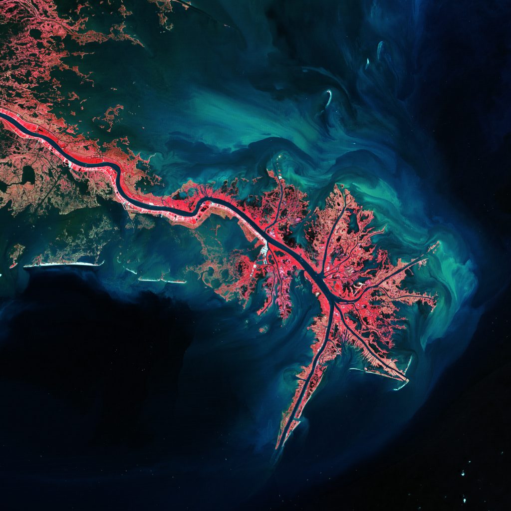
The Mississippi River Delta region is a 12,000 km2 area of land that stretches from Vermillion Bay on the west, to the Chandeleur Islands in the Gulf of Mexico on the southeastern coast of Louisiana. It is part of the Louisiana coastal plain, one of the largest areas of coastal wetlands in the United States. The Mississippi River Delta is an important coastal region for the United States. The coastal area is the nation’s largest drainage basin and drains about 41% of the contiguous United States into the Gulf of Mexico at an average rate of 470,000 cubic feet per second.
.
Image: http://www.esa.int/
.
#earthimages #earthimage #upintheair #abovetheclouds #satelliteimage #satelliteimages #EarthOverhead #MississippiRiverDelta #MississippiRiver #MississippiDelta #RiverDelta #VermillionBay #Louisiana #ChandeleurIslands #GulfofMexico


