
Brazil
https://goo.gl/maps/2G5zDccGFCk
.
.
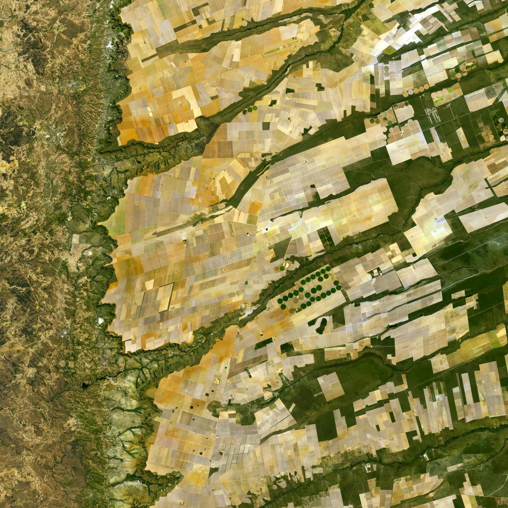
Central-eastern Brazil – more specifically where the Bahia, Tocantins and Goiás states meet.
.
Here we can see a large, flat plateau blanked with fields benefiting from rich soils and an apparent abundance of water, before falling off into a green, hilly valley (left). The straight lines in the image are roads, such as the highway running in a nearly straight line from the centre-top to bottom of the image.
.
The area is particularly known for soybean production. The country’s soybean output has increased by more than 3000% since the 1970s, and Brazil is the second largest global producer of soybeans after the US.
.
Other crops in this area include corn, coffee and cotton.
.
A distinctive feature in this image is the circles – mainly at the centre. These shapes were created by a central-pivot irrigation system, where a long water pipe rotates around a well at the centre of each plot. The varying colours show different types of crop, or different stages of growth.
.
This image was captured by the Copernicus Sentinel-2A satellite on 8 August 2016.
.
Image & Text : http://www.esa.int/
.
#earthimages #earthimage #upintheair #abovetheclouds #satelliteimage #satelliteimages #EarthOverhead #overview #overvieweffect


