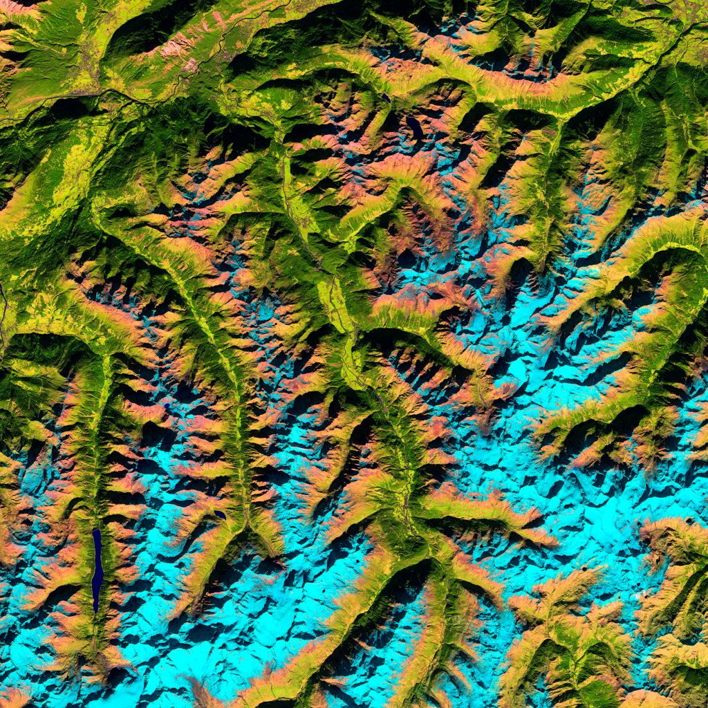
Ötztal Alps, Tyrol, Austria
https://goo.gl/maps/XTgpS4V8DH92
.

.
The shadows across the image may play tricks on the eye, making the valleys – the green areas – look like they stand higher than the light blue mountains. Sometimes rotating the image so the shadows fall in a different direction can ‘fix’ this optical illusion.
.
Snow appears in shades of blue in this unusual false-colour image using light in the near- and shortwave infrared part of the spectrum. This colouring makes it easier to distinguish between snow and vegetation. It also allows us to differentiate between clouds and snow, which is difficult in other parts of the spectrum as they are usually both white. But there are no clouds visible in this image to demonstrate the effect.
.
The highest peak in the Ötztal range is Wildspitze, standing over 3770 m. The mountain is visible in the lower-left corner, east of the elongated lake, Gepatschspeicher.
.
The well-preserved natural mummy of a man from about 5300 years ago was found just 12 km south of Wildspitze (not pictured). The body was discovered by two tourists in 1991, and named ‘Ötzi’ after the Ötztal Alps.
.
While the discovery of the mummy allowed for new insights into the Chalcolithic period, it also revealed new information on changes in climate over the past millennia. Together with other evidence, the burial of the corpse by snow and ice indicates a rapid climactic cooling soon after his death, preserving the body for over 5000 years before glacial melt from rising temperatures exposed the mummy.
.
Ref: http://www.esa.int/
.
#earthimages #earthimage #upintheair #abovetheclouds #satelliteimage #satelliteimages #EarthOverhead #overview #overvieweffect #Ötztal #Alps #Tyrol #Austria #mummy #Wildspitze #Gepatschspeicher


